Tuesday, 7 August 2012

Tuesday 7 August 2012 – Portree to Fladday Harbour (Raasay)


Follow the track on Google Maps.

Follow the track of the walk.

IMG_6499
Cliffs on coast N of Portree
IMG_6501
The Storr
IMG_6517
Entering Fladday Harbour
IMGP2513
Tucking in at the Tuck Shop
IMG_6525
Calum’s Road
IMG_6526
Looking N over Rona
IMG_6531
Dun Caan with possibly Blaven behind
IMG_6533
View towards Portree
IMG_6538
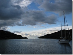
Sheltered anchorage

Monday, 6 August 2012

Monday 6 August 2012 – Portree and the Quirang

Took the bus to Staffin, then biked and walked to the Quirang and back to Portree. Total distance 50.1 km which is about the same as the bike and run part of the Olympic triathlon.  OK, we skipped the swim and we took longer, but our route had a lot more up and down!

Following the directions in the walks book carefully, we started up a steep gully to try to find The Table.  Could not get anywhere up the top, so descended another gully, which was not quite as steep and then saw The Needle.  Reading the walks book even more carefully we found The Table which was well in the cloud.

Long cycle back as we decided we did not need the bus.
IMG_6459
Looking up the wrong gully for The Table
IMG_6466
The Needle
IMGP2496
The Needle in cloud
IMG_6468
Looking for the Table again
IMG_6469
Lunch at The Table
IMG_6472
Still no view

Sunday, 5 August 2012

Sunday 5 August 2012 – Portree

Hoping the cloud might lift, we biked up the road to the Old Man of Storr (it’s a pinnacle not a person).  Not the most enjoyable ride as there was more uphill than I expected (to 175m) and we were going into the wind.  Also the single track roads are about 1.3 track, so cars tend to squeeze past rather than wait for a passing place.

The cloud remained low so we soon walked up into it, and when we got to the base of the old man we could just about see the top of it.  However there was no problem finding the way as the path was well trodden and there were dozens of people going up and down, many of whom were foreign visitors.  The original plan had been to go up the Storr which is the main mountain behind the Old Man of Storr.  However with no visibility this did not seem like a good idea, so we came down again with all the other walkers.

Follow the track of the walk.
IMGP2467
One of these is the Old Man of Storr
IMGP2476
Thyme

Saturday, 4 August 2012

Saturday 4 August 2012 – Strollamus to Portree

The cloud was low and the walk we had intended would not be much good with no visibility so we decided to go to Portree.  Motored out of the loch, then sailed very slowly.  After a brief sandwich lunch we could see wind on the water and when the wind arrived we soon started sailing properly, then had to put in a reef.  At the Raasay Narrows we put in a second reef and continued to Portree beating into N5, which came as a surprise as the wind has generally been light on this trip.  Somehow it’s more difficult to cope with wind that arises part way through the day – in this case it seemed just like the wind of the previous 2 days, which we had put down to sea breeze, but much stronger.

Portree harbour was very sheltered and we picked up a visitors’ buoy.  Maybe tomorrow we will visit the Old Man of Storr

Follow the track on Google Maps.
IMGP2463
Portree Harbour. We are in the distance on the left
IMGP2458
Portree Harbour – we are on left

Friday, 3 August 2012

Friday 3 August 2012 - Raasay to Skye (Strollamus)

After a coffee and scone at Raasay House Hotel we took a look at some of the nearby items of interest which included the strange stone mermaids by the pier, ancient rock carving by the pier, souterrain which is also ancient. It’s original purpose is not known but in recent years it was rescued from being a domestic rubbish dump.

Sailed slowly downwind to Strollamus, where we had booked a mooring.  Pat’s cousin Gina lives just down the road. She collected us in her car and gave us a brief tour of the area from Broadford to Torrin.  On the way we ate fish and chips in the churchyard of a ruined church in a wide valley full of archaeological sites.

Tomorrow we could walk up the hills near the mooring or move on as there is a noisy road along the side of the sea loch here.

Follow the track on Google Maps.
IMG_6434
Ugly Mermaid and Raasay House under restoration
IMG_6445
Raasay Narrows, with the E coast of Skye on left
IMGP2432
Visitors’ moorings, with mountains of Skye behind
IMGP2433
In the souterrain
IMGP2451
Dun Borodale Broch

Thursday, 2 August 2012

Thursday 2 August 2012 – Crowlin Is to Raasay (Churchton Bay)

Sailed across rather slowly and picked up a visitors mooring in Churchton Bay.  With fine weather and good visibility we took an evening walk up Dun Caan just in case the weather is no good tomorrow.


Follow the track on Google Maps.
Follow the track of the walk.
IMGP2402
Anchored at Crowlin Is
IMG_6404
Leaving Crowlin Is
IMG_6408
Razorbills
IMGP2414
Visitors’ moorings at Churchton Bay
IMG_6417
Approaching Dun Caan
IMG_6419
Loch at the top of a hill
IMG_6421
Too early to watch the sunset with a glass of wine

Wednesday, 1 August 2012

Wednesday 1 August 2012 – Mallaig to Crowlin Islands

Overnight our rating of Mallaig as a stopping-place fell even further.  With the East wind coming over the hill the harbour was generally sheltered but suffered occasional gusts in strange directions.  As a result the boats on the moorings went round in circles. The boat next to us bumped another boat and nearly bumped us.  We moved to a different mooring which was very close to 2 other moorings but we reasoned it was better to bump into an empty buoy rather than a boat.  After an uncomfortable night we had to pay £15 which is a bit steep for no facilities apart from the buoy itself. The marina man accepted the moorings are too close together but has not yet got he harbour master to move them.  It would seem that EU, HIE and others have provided lots of money for the moorings but it has not been spent wisely.

We dodged a rain shower by having tea before leaving, but more were to follow.  The East wind was today enough to get us sailing properly at last, with a good breeze coming out of Loch Nevis and Loch Hourn, but went light and variable at times.  The channel seemed like a dead end, until we could see the narrow Kyle Rhea which we drifted through with a light following wind and 5 knots of tide.  Once in Loch Alsh we lost the tide in the wider water and everything went slow again, so we eventually started the engine just before passing under the bridge as we seemed to be at the end of the tide through Kyle Akin.  Once clear of the kyle we must have left the shelter of the land and the wind came again, giving a pleasant sail to the Crowlin Islands.  We had entered an inland sea, bounded by the mainland on one side and Skye on the other and filled with a lot of interesting islands, some of which we hope to visit.  The different islands have different characters, from the big mountains on Skye, the distinct peak of Dun Caan on Raasay, to the smooth hump of Scalpay and the tatty pine trees on the low island of Pabay.

We anchored near another boat in the inner pool between the Crowlin Islands and enjoyed a fine evening.  Tomorrow we will explore the islands and then hope to move over to Skye to visit my cousin Gina on Friday.

Follow the track on Google Maps.
IMG_6360
Kyle Rhea.
Somewhere ahead there is a way through
IMG_6386
Approaching Skye bridge
IMG_6397
Through the bridge – another shower behind.
IMG_6399
An inland sea waiting to be explored
IMG_6401
Anchorage in the Crowlin Islands